Grey Belt
Approval preview · policy, appeals and council assessments checked 21 October 2026
Home / Examples
Illustrated · Site types

Grey belt examples

Seven typical sites, drawn as simple plans, showing how the purposes are judged and which route might apply. Each one is linked to a real appeal decision.

The plans are illustrations of typical situations, not real sites. Every case turns on its own facts and on planning judgement.
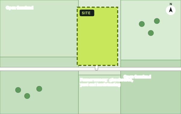
Illustrative plan: former nursery, yard and hardstanding
Likely grey belt

Former nursery, yard and hardstanding

Previously developed land: a lawful commercial nursery with glasshouses, buildings and hardstanding, set back from the edge of a village.

Purpose A
Weak: not next to a large built-up area
Purpose B
Weak: not in a gap between towns
Purpose D
None: no historic town nearby
Routes
GB7(1)(g) grey belt, or GB7(1)(e) redevelopment of previously developed land

Compare: Former Weylands Treatment Works, Walton-on-Thames (Elmbridge, APP 3352866, allowed April 2025): previously developed land and grey belt. Note that agricultural buildings are not previously developed land.
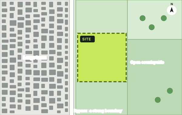
Illustrative plan: field enclosed by housing on three sides
Likely grey belt

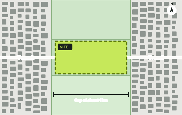
Field enclosed by housing on three sides

A paddock wrapped by the edge of a town, with a road along its fourth side. Developing it would round off the settlement rather than push into open country.

Purpose A
Moderate or weak: contained by existing development
Purpose B
Weak: no gap between towns
Purpose D
None
Watch for
Inspectors may assess the site on its own, not as part of a wider parcel the council rated 'strong'

Compare: paddocks south of Daws Heath Road, Thundersley (Castle Point, 6007184, allowed Sept 2026): assessed separately from the wider parcel; 58 homes with 50% affordable housing.

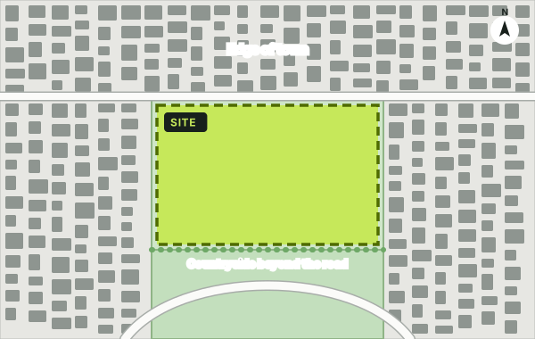
Illustrative plan: open field beyond a bypass
Not grey belt

Open field beyond a bypass

An open field on the far side of a bypass that currently forms the edge of a large town. Development would jump a strong boundary and create a 'finger' into open countryside.

Purpose A
Strong: open, next to a large built-up area, no containment
Result
Inappropriate development: needs very special circumstances
Annex E
'Strong' where development would create an incongruous pattern, such as a finger of development

Compare: Shafford Knoll Farm, Nash Mills (Dacorum, 3373146, dismissed March 2026) and Willow Tree Farm, Chalfont St Peter (Buckinghamshire, 6009281, dismissed Sept 2026).

Illustrative plan: land in the gap between two towns
Depends on the gap

Land in the gap between two towns

A field on the road between two towns about a kilometre apart. If it forms a substantial part of the gap and building would erode visual separation, it contributes strongly to purpose B.

Purpose B
Strong if a substantial part of a narrow gap; moderate if a small part or screened
Towns only
Villages do not count for purpose B
Tip
Topography, woodland and existing buildings can reduce the role of land in the gap

Compare: Grove End, Bagshot (Surrey Heath, 3347530, allowed March 2025): Bagshot and Windlesham were treated as villages, so purpose B carried little weight.

Illustrative plan: plot on the edge of a green belt village
Grey belt; location decides

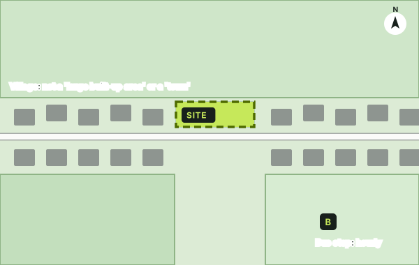
Plot on the edge of a Green Belt village

A gap in the frontage of a small village. Villages are not 'large built-up areas' or 'towns', so the land usually contributes weakly to purposes A and B. The battle is usually over sustainable location.

Purposes
Usually weak for A and B
Key test
Sustainable location (TR3): footways, lighting, buses, shops
Also
Limited infilling in villages, GB7(1)(c), may apply

Compare: Coppice Road, Higher Poynton (Cheshire East, 6010471, allowed) versus Oaklands Drive, Copthorne Bank (Tandridge, 6011736, dismissed on location), both Sept 2026.

Illustrative plan: land within 800 m of a well-connected station
New route in 2026

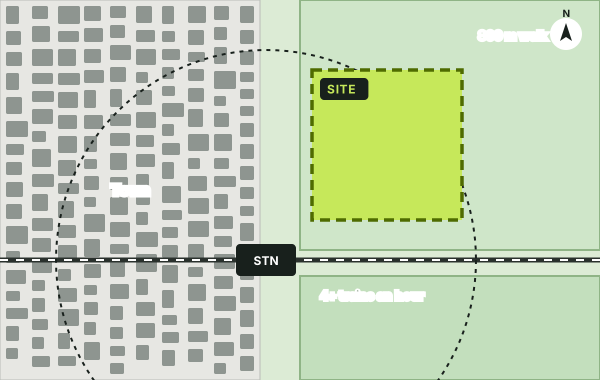
Land within 800 m of a well-connected station

Fields on the edge of a town, about a ten-minute walk from a station with four or more trains an hour in a top-80 Travel to Work Area.

Route
GB7(1)(h): grey belt status and unmet need not required
Tests
Reasonable walking distance, well related, infrastructure capacity, Golden Rules for major schemes
Warning
The walking route must be realistic: lit, with footways

Compare: land beside Hatton station (Warwick, 6006637, dismissed Sept 2026): an unlit road and a bridge with no footway meant station proximity alone was not enough.

Illustrative plan: field beside a listed farmhouse
Changed in 2026

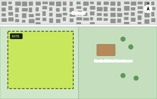
Field beside a listed farmhouse

A field next to a Grade II listed farmhouse. Under the 2024 definition, if heritage policy gave a strong reason to refuse, the land was not grey belt at all. Now it can be grey belt, with heritage judged separately.

2024 rules
Excluded if footnote 7 (heritage) gave a strong reason to refuse
2026 rules
Classification depends only on purposes A, B and D
Still applies
Harm to the listed building's setting is weighed under heritage policy

Compare: Toot Hill (Epping Forest, 3376859, dismissed March 2026) and Boscobel Lane, Bishops Wood (South Staffordshire, 3363067, dismissed Nov 2025), both excluded under the 2024 wording; and Sutton's 2026 assessment.

Real photographs of appeal sites can be added for launch, with permission from the landowners or with licensed aerial imagery.

Own land in the Green Belt?

Find out whether it could be grey belt, which route to permission might apply, and what the Golden Rules would ask of a scheme.